
AsianScientist (Apr. 1, 2015) – By K.S. Harikrishnan – An Indian satellite, officially launched in March, will provide positioning services to all South Asian countries.
“The South Asian Association for Regional Cooperation (SAARC) countries can use our navigation system,” B. Jayakumar, director at the Vikram Sarabhai Space Center, Thiruvananthapuram tells SciDev.Net. SAARC members countries included are Afghanistan, Bangladesh, Bhutan, India, Maldives, Nepal, Pakistan and Sri Lanka.
According to Jayakumar, the satellite system will provide standard positioning services to all users while restricted, encrypted services will be accessible to authorized users.
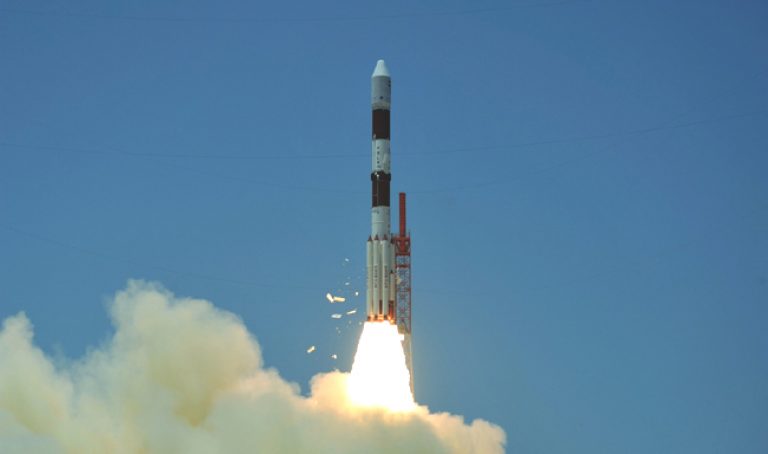
This fourth satellite in the Indian Region National Satellite System (IRNSS-1D) constellation was launched by India’s Polar Satellite Launch Vehicle (PSLV)-C27 from a spaceport at Sriharikota, Andhra Pradesh state on March 28, 2015.
According to Devi Prasad Karnik, public relations director, Indian Space Research Organisation, Bangalore, the successful launch and commissioning of the IRNSS-1D would place India in a club of countries that operate their own satellite navigation systems.
The US operates the popular Global Positioning Satellite (GPS) while Russia has the Russian Global Navigation Satellite System (GLONASS) and China the Beidou Navigation Satellite System. The European Union’s Galileo positioning system is under development.
IRNSS has both commercial and strategic applications. It caters to the needs of civil aviation and also requirements for positioning, navigation and timing based on an independent satellite navigation system.
IRNSS is designed to provide accurate position information service to users extending up to 1,500 kilometres from India’s boundary. The extended service area falls in a rectangle formed by Latitude 30 degree South to 50 degree North and Longitude 30 degrees East to 130 degrees East.
The first satellite IRNSS-1A was launched in July 2013, followed by IRNSS-1B in April 2014 and IRNSS-1C in October 2014. The entire IRNSS constellation of seven satellites is scheduled to become operational by 2016.
———
Source: SciDev.Net.
Disclaimer: This article does not necessarily reflect the views of AsianScientist or its staff.