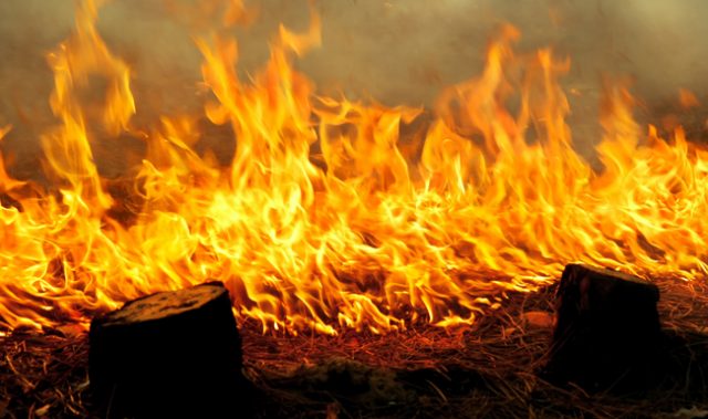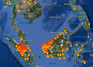

AsianScientist (Sep. 2, 2013) – NASA’s Terra satellite has captured an image of actively burning areas in Indonesia, indicating a fresh round of forest fires.
The natural-color image, photographed on August 27 with its Moderate Resolution Imaging Spectroradiometer (MODIS) instrument, shows actively burning area (outlined in red) as detected by MODIS’s thermal bands.

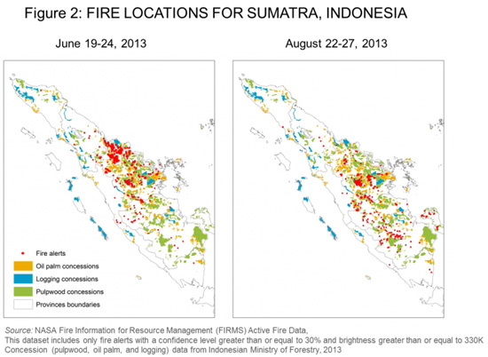
Widespread clearing of rainforests and peatland by oil palm, logging, and pulpwood companies is a yearly ritual in Sumatra, a large Indonesian island with a population of 50 million people. Although now an illegal practice, ‘slash-and-burn’ clearing techniques have been used for centuries to clear land for the planting of new crops.
In June, the fires resulted in a choking smog so lethal that a new all-time high of 401 on the Pollution Standards Index was recorded in the nearby city-state of Singapore. A measurement over 400 is potentially life-threatening to the ill and elderly, according to the Singapore National Environment Agency.
A staple for cooking throughout Southeast Asia, palm oil is the single largest traded vegetable oil commodity in the world, used in the manufacture of cosmetics, soaps, pharmaceuticals and industrial products such as biodiesel fuel.
——
Copyright: Asian Scientist Magazine.
Photo: Jeff Schmaltz LANCE/EOSDIS MODIS Rapid Response Team, GSFC.
Disclaimer: This article does not necessarily reflect the views of AsianScientist or its staff.